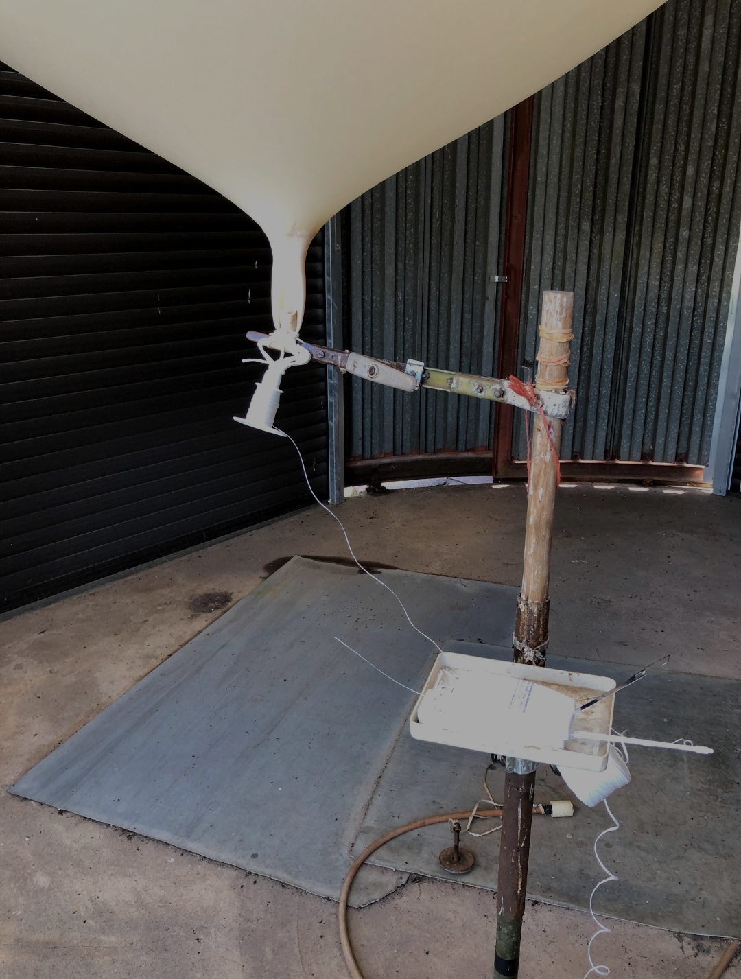
Designing from scratch or modifying existing ideas, with 3D printing the world is your oyster and it goes perfectly hand-in-hand with electronics design with the need for quick and accurate enclosures that normally doesn't exist on the market.
With a wealth of data available for consumption in real-time, you need to have it available in the format and scope that your devices need, be it IoT devices, watches or Smart Home Devices. Customized APIs have your back.
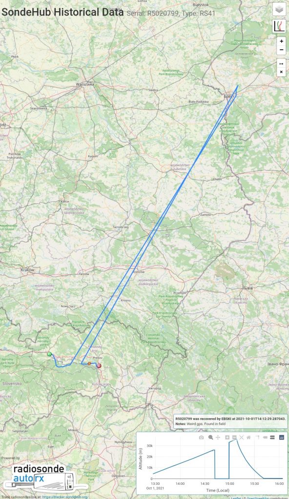
This was quite a straightforward recovery of this flight from Poprad(Ganovce).
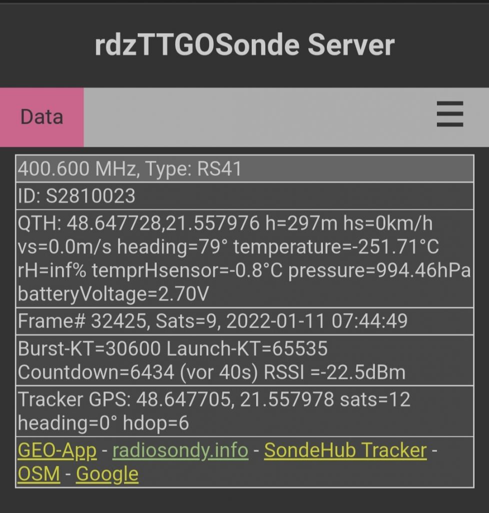
There were some quite severe winds and I found this sonde and balloon in an old orchard and from the telemetry readings you can see that the temperature sensor did not survive the landing.
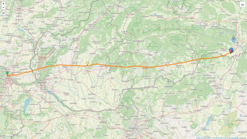
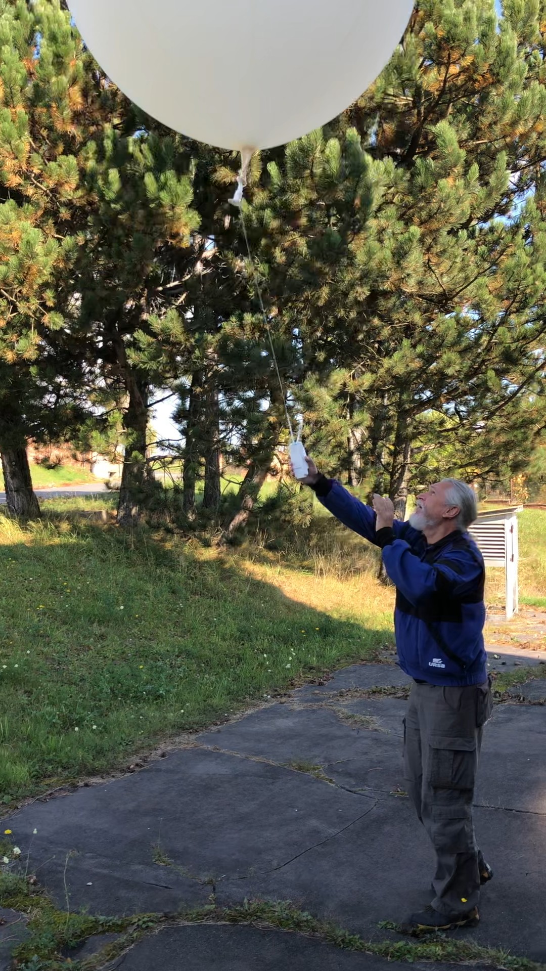
This was an exciting one 😀 It was my first sonde from Vienna. I was actually suprised to see it appear on my station data in the morning so decided to attempt to collect it.
Since it was in quite a flat area, I needed to get quite close before I was able to receive a signal from it. It was in a freshly ploughed field.
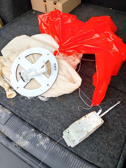
I was pleasantly surprised to see that it was an RS41-SG model with a parachute and fully intact balloon. This is the most complete one I’ve found so far.
Also of intrest is how far it travelled after it burst.
About halfway through the flight the number of satellites seen by the sonde started dropping. When it got to 6, it started giving timestamp errors. It then started sending out invalid GPS coordinates.
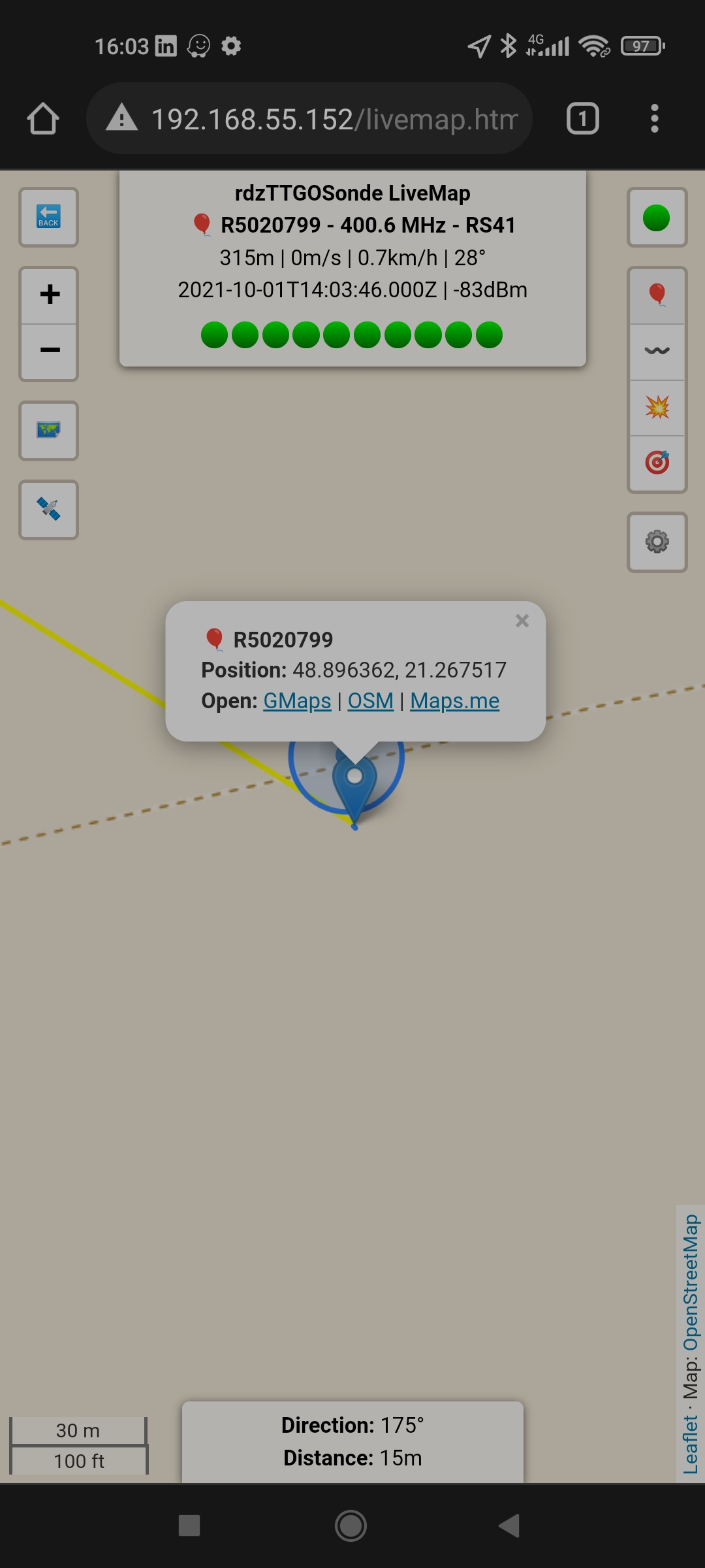
You can view the flight path and sensor data for RS41-SGP R5020799 on the SondeHub tracker! https://sondehub.org/R5020799
As you can see, it was reporting to be flying at 40m altitude in Belarus for some time. This data was reported by multiple receivers and also affected another sonde T0340269 which reported this identical path….
What would cause this? GPS spoofing by satellite? I’m very curious.
The sonde itself I located after it started picking up more satellites again and corrected the location for the rest of the flight. The meteo telemetry was correct for the whole flight.
Let me know in the comments, have you got any theories?